Bridges to Somewhere: UCLA AUD studio reimagines LA freeways as boon for the Olympics
Aug 17, 2026
Roads and streets bind Los Angeles. They also fragment it.
LA’s freeways represent some of the largest contiguous public-land holdings in the nation, yet they behave as high-noise, high-pollution, single-use corridors that cut neighborhoods apart and render mobility a lost cause. Individual and collective movement stall out, while pockets of prime urban space sit unused beside all of that concrete.
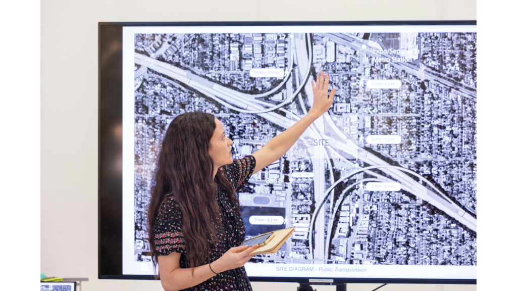
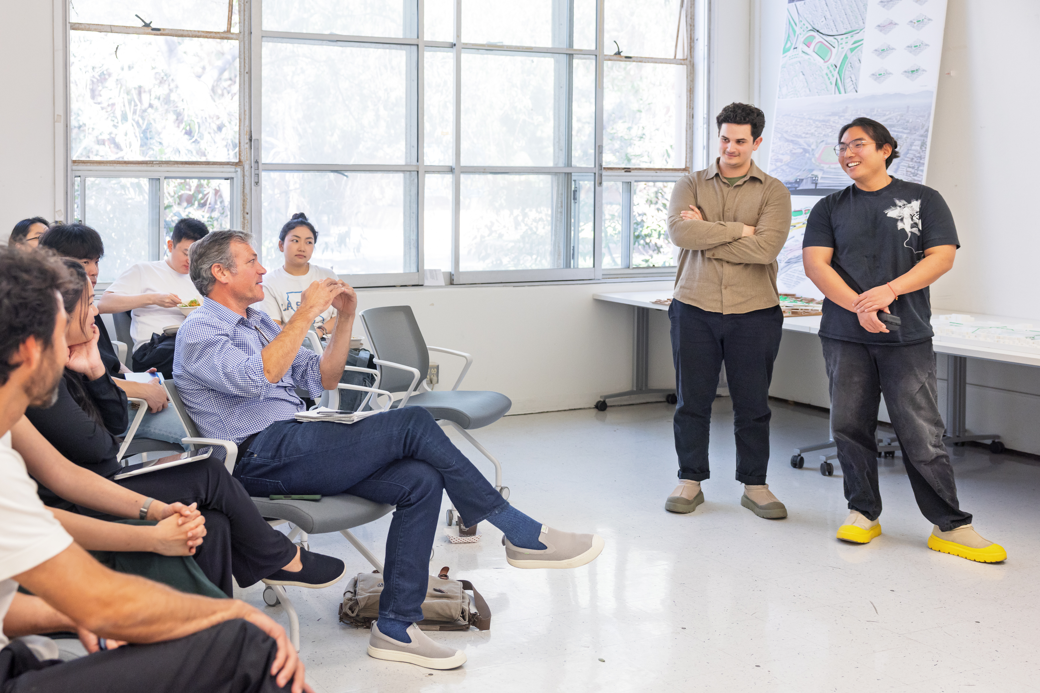
With the 2028 Summer Olympics now less than two years away, LA faces a reckoning with how it uses its public space, how it supports mobility, and how it prepares to host the world. This past spring, architect Leon Rost took on the challenge with his UCLA Architecture and Urban Design studio, "Social Infrastructure: Reconnecting the Fragmented City."
Rost is a Partner at Bjarke Ingels Group (BIG) and leads the firm's Los Angeles office. He asked his UCLA AUD students to design "programmatic bridges" — hybrid structures for sport, housing, and gathering — across segments of the 405, the 10, and the 110, freeways that form Southern California’s transit backbone.
The studio's premise: LA's freeway network isn't a permanent scar. It's a malleable asset.
“People assume ideas like these die on feasibility, that building over a freeway is too hard, too expensive, too utopian,” Rost says. “It isn't. The land is public, the engineering is proven. What actually stands in the way is not physics but policy: the air above the freeway is space we've decided not to use. When enough potential accumulates around these sites, policies can change.”
Students prioritized localized, practical interventions rather than sweeping megastructures–urban design that can patch, connect, and heal specific communities rather than paper over the whole city at once.
The irony driving the studio is a familiar one: LA is a global capital of outdoor recreation and healthy living, yet it ranks near the bottom of major U.S. cities in park acreage per capita, not to mention all that pollution. It's supposedly a city of free movement, yet peak-hour traffic often crawls slower than a bicycle. That contradiction has calcified into a kind of civic fatalism: the sense that you simply can't get there from here, wherever “there” and “here” might be.
Across three sites, five teams of UCLA AUD students tried to answer a shared question: can unused land next to LA’s freeways — or even the freeways themselves — become shared space that people actually want to use?
Site 1: Breaking the Megastructure at the Coast
At the western end of the 10 Freeway, where asphalt meets the Pacific, sits a gridded pocket of Santa Monica. It’s home to a lot of traffic, but tends to be a place people pass through rather than linger.
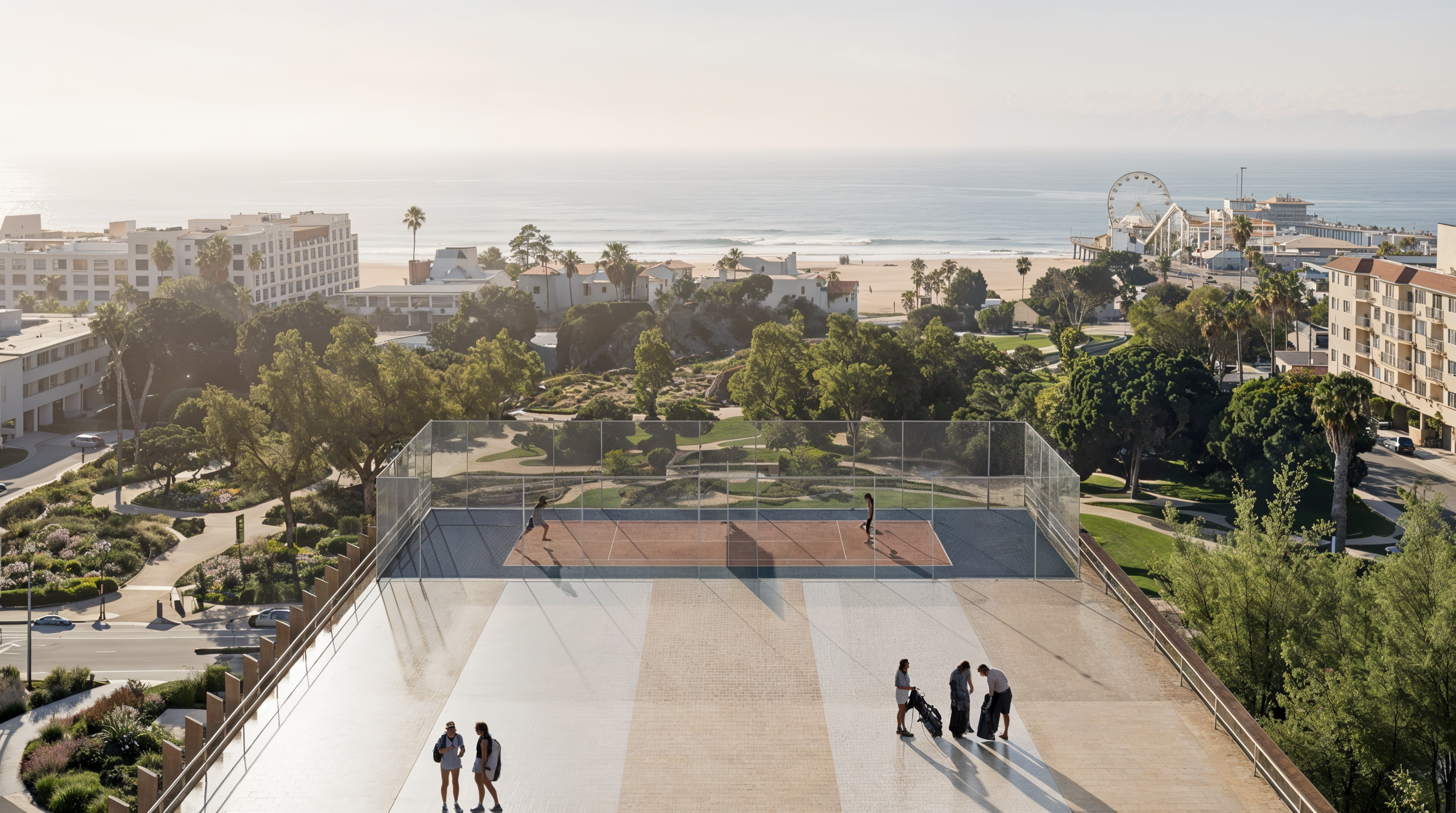
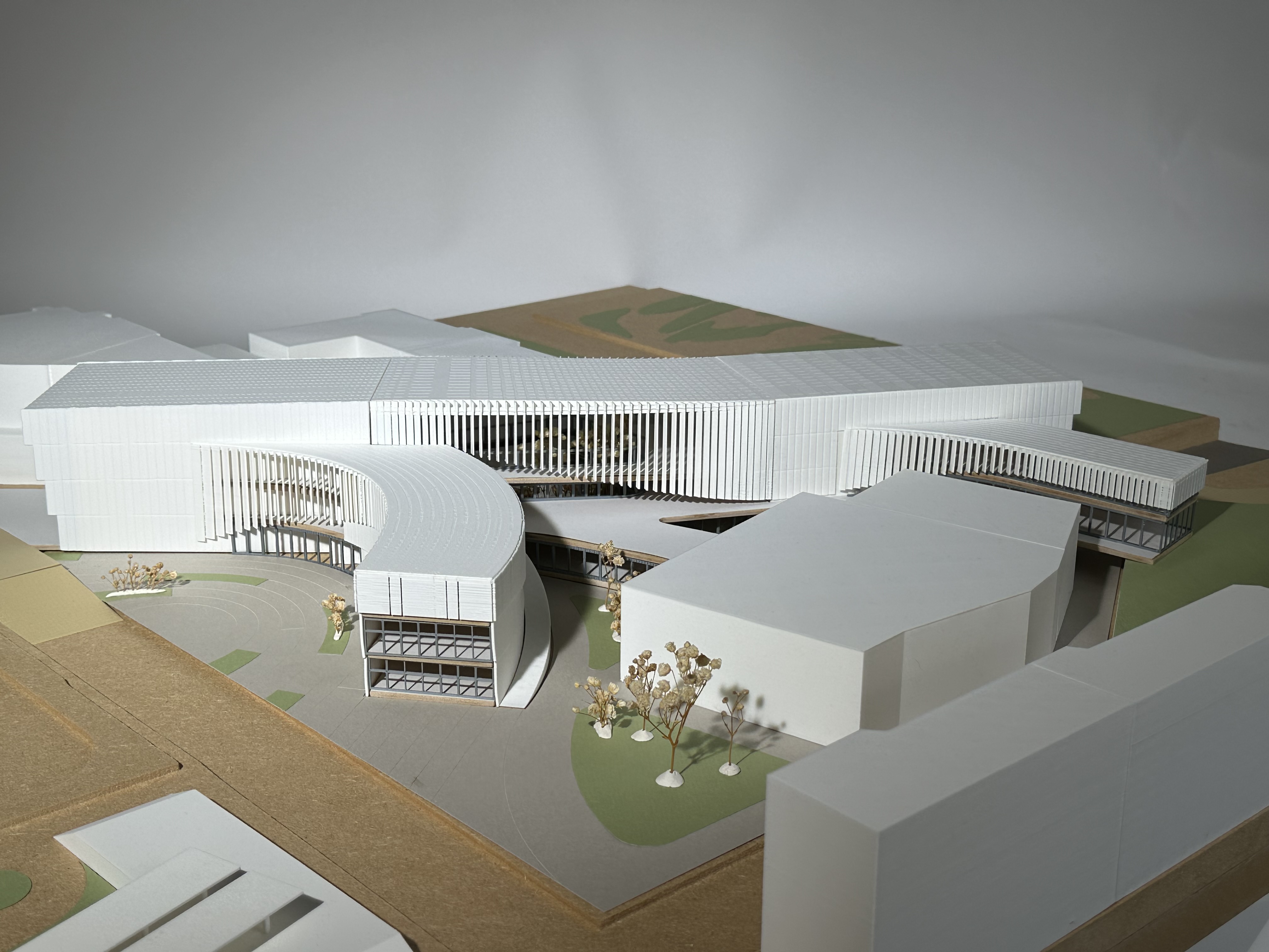
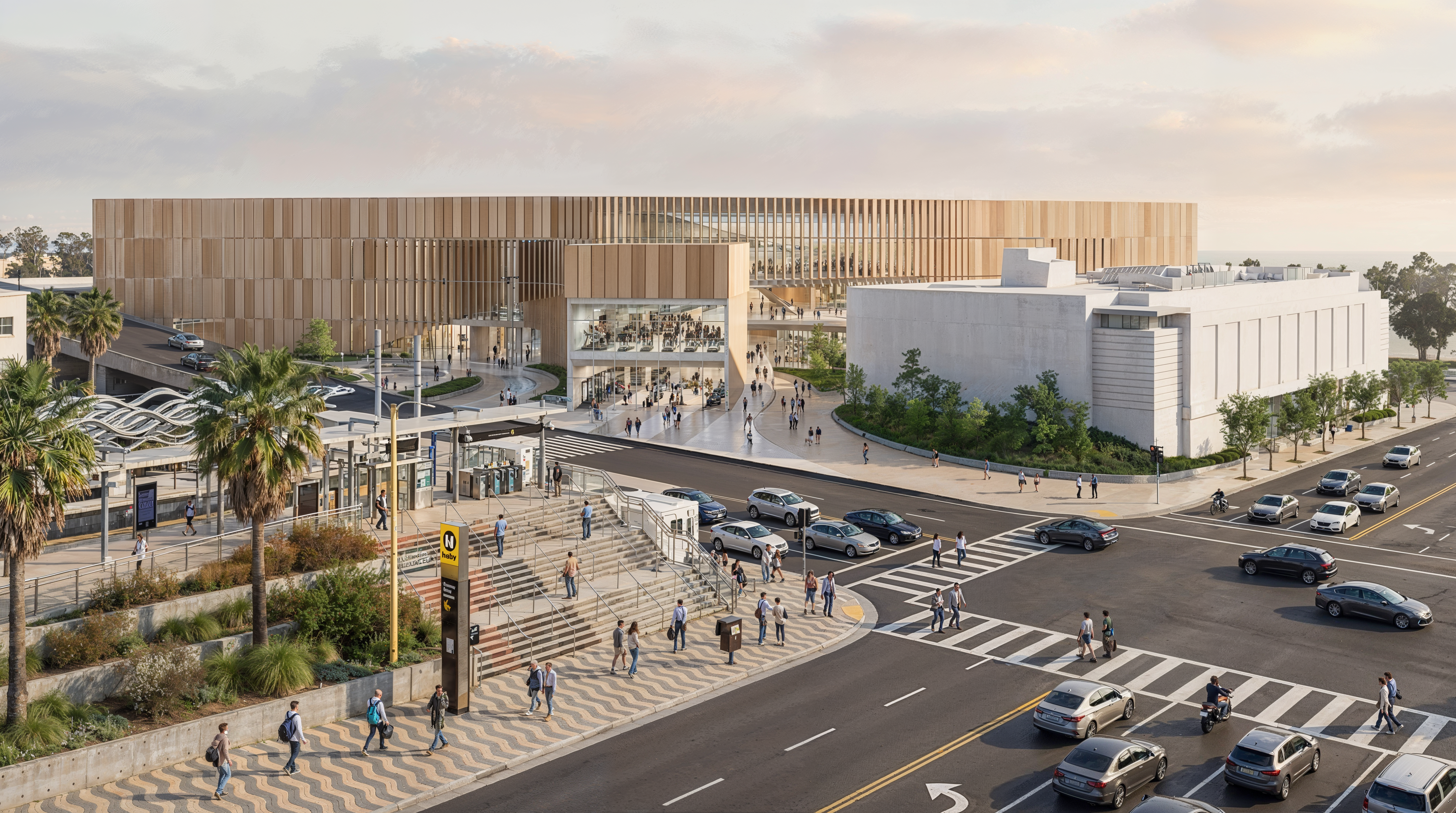
With their proposal "Nexus," Jae Won Lee, Xuanrun Yi, and Yanqi Li treated this edge condition as raw material for civic life, inviting the public into a shared space. Basketball courts anchor either end of the structure, which also functions as a hub of pathways redirecting foot traffic toward the Third Street Promenade, the Santa Monica Metro station, and nearby parks and beaches. While the ground floor remains student-only, a sloped second level opens the building to shared and public space.
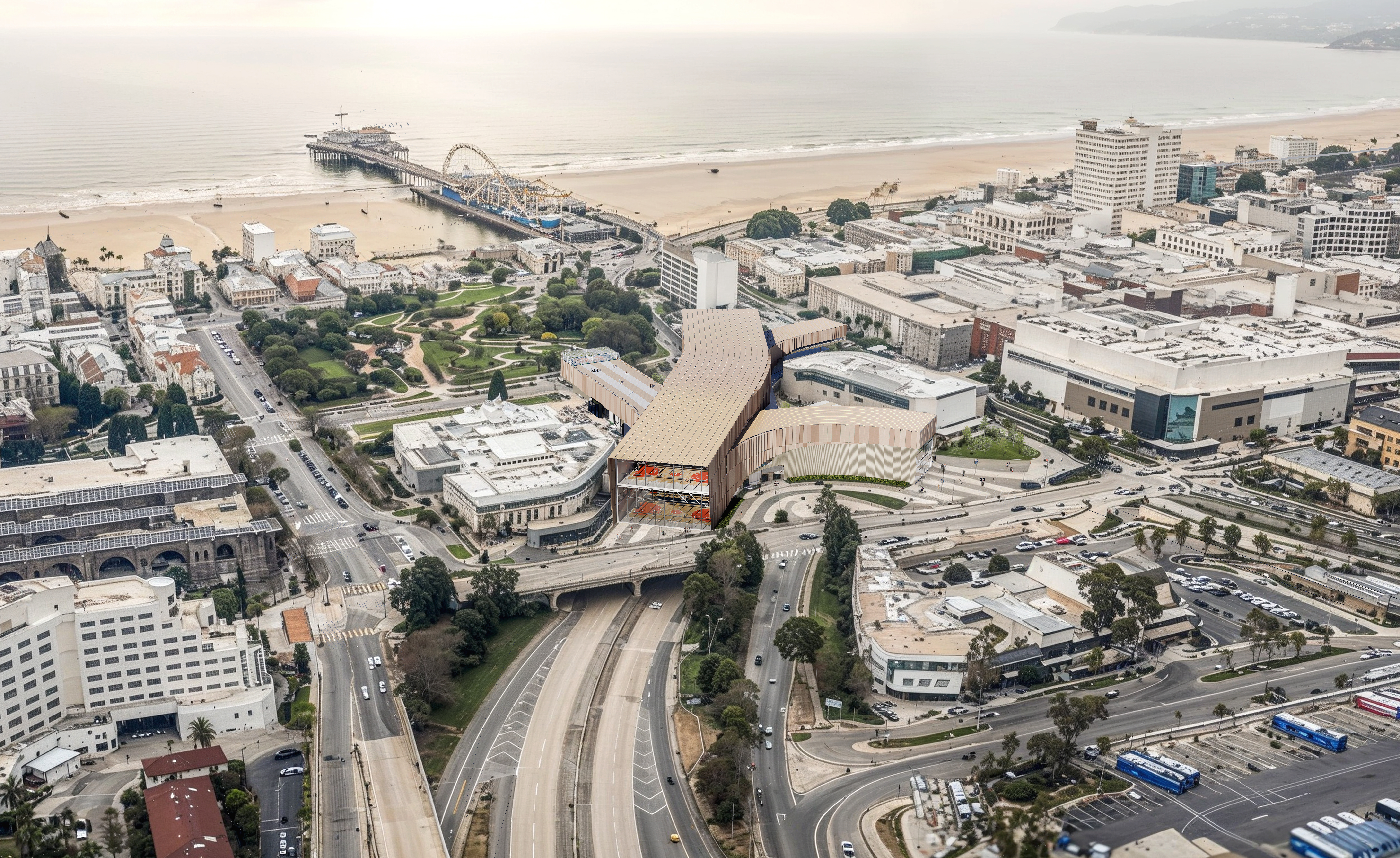
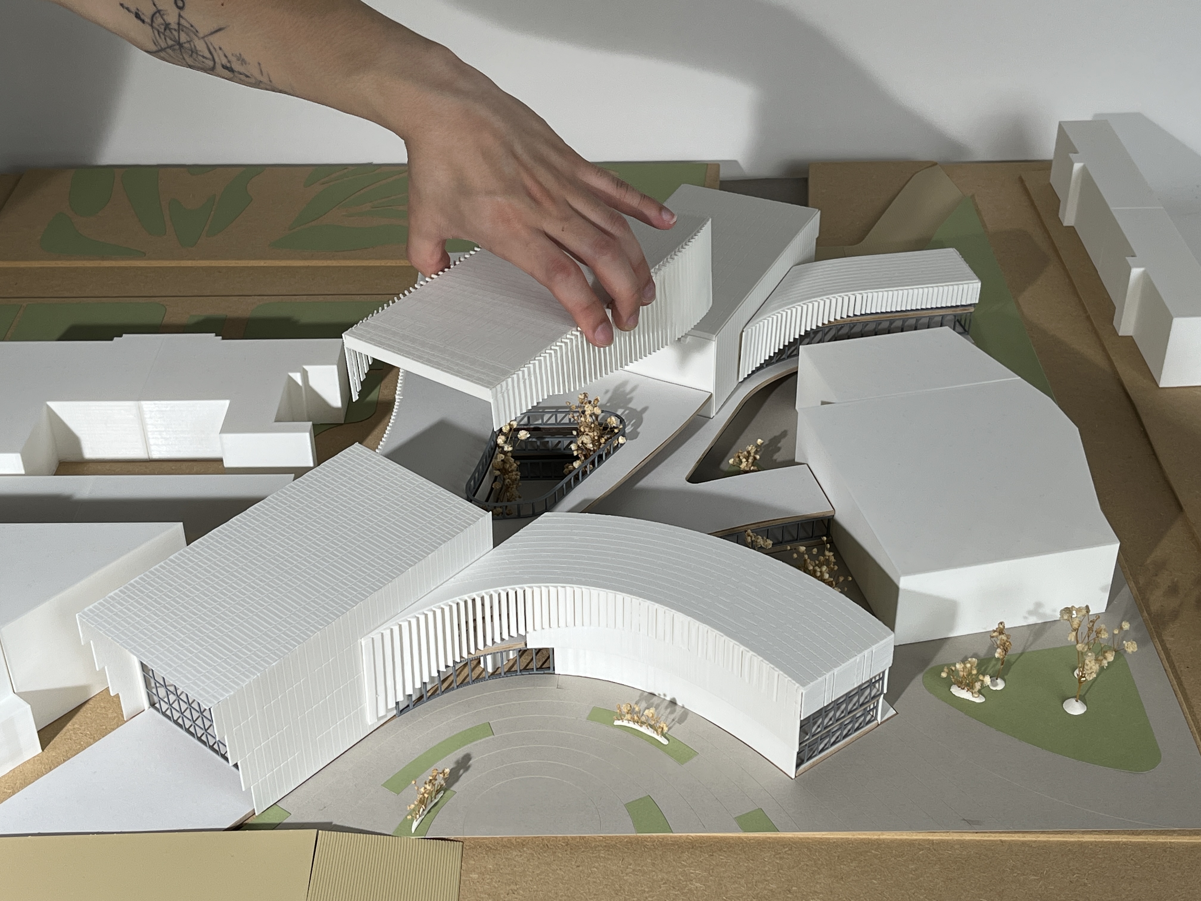
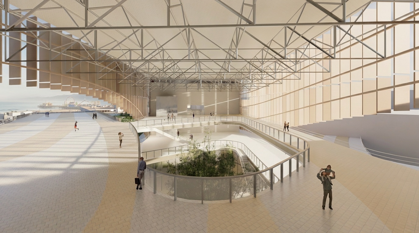
The team's biggest design challenge was scale. Dropped next to Santa Monica City Hall and the historic Sears Building, a single, dominating slab risks overwhelming its neighbors. So they broke up the "bar" building instead, prioritizing porosity over monumentality, with clear sightlines from the Metro stop through to the Civic Center. The building also faces Tongva Park rather than turning its back on the city, positioning itself as a kind of refuge from crowded streets, with bleachers, arena seating, and an active rooftop.
Site 2: Healing the Scars of Sugar Hill
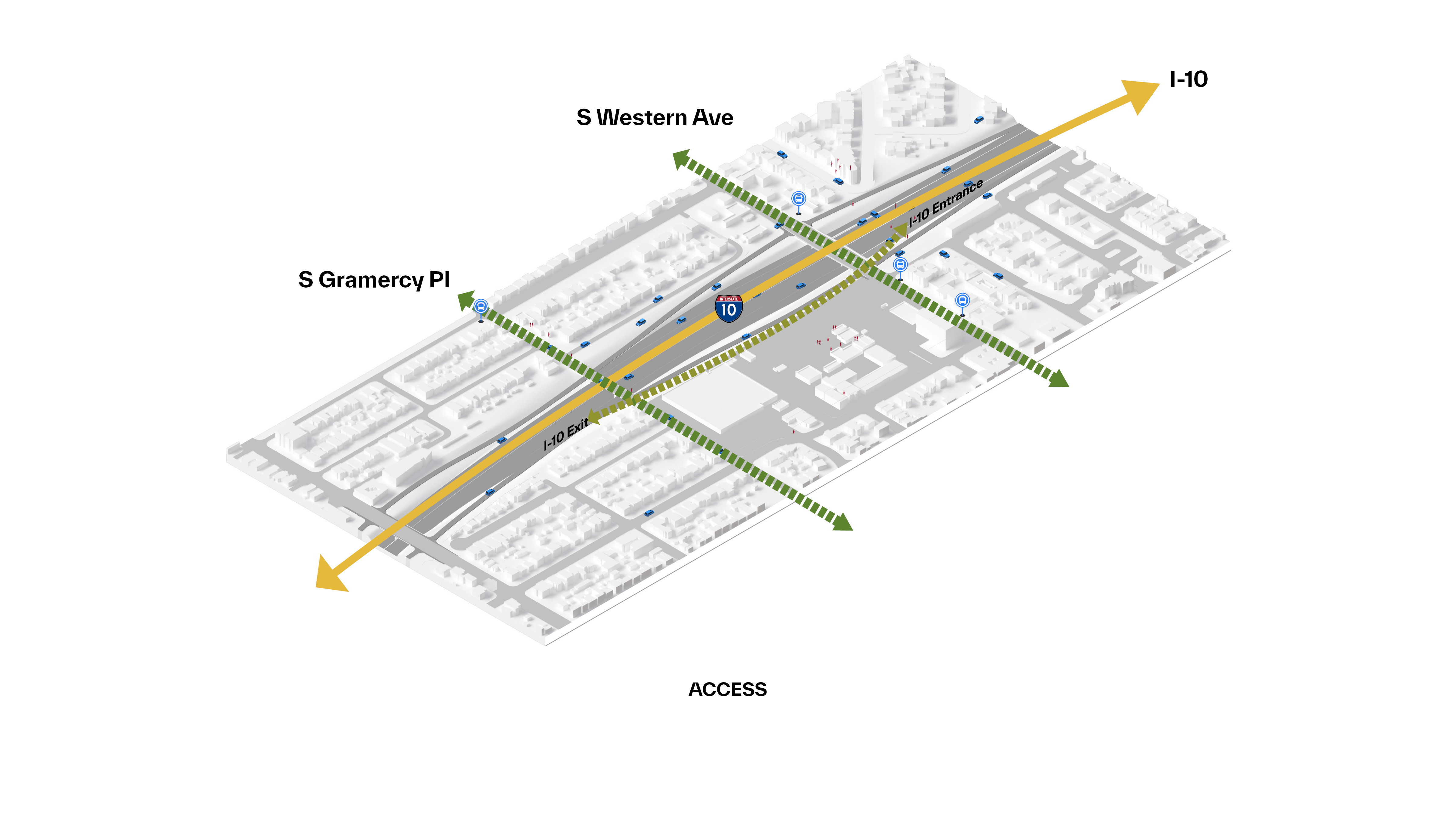
Just west of Downtown Los Angeles, the construction of the 10 Freeway in the 1950s and 1960s tore directly through Sugar Hill, once a thriving, historically Black neighborhood in what's now West Adams. Today, an off-ramp between Gramercy and Western Avenues severs the Jefferson and West Adams communities from each other.
Two teams took on this roughly 400,000-square-foot site, with different instincts about how to repair it.
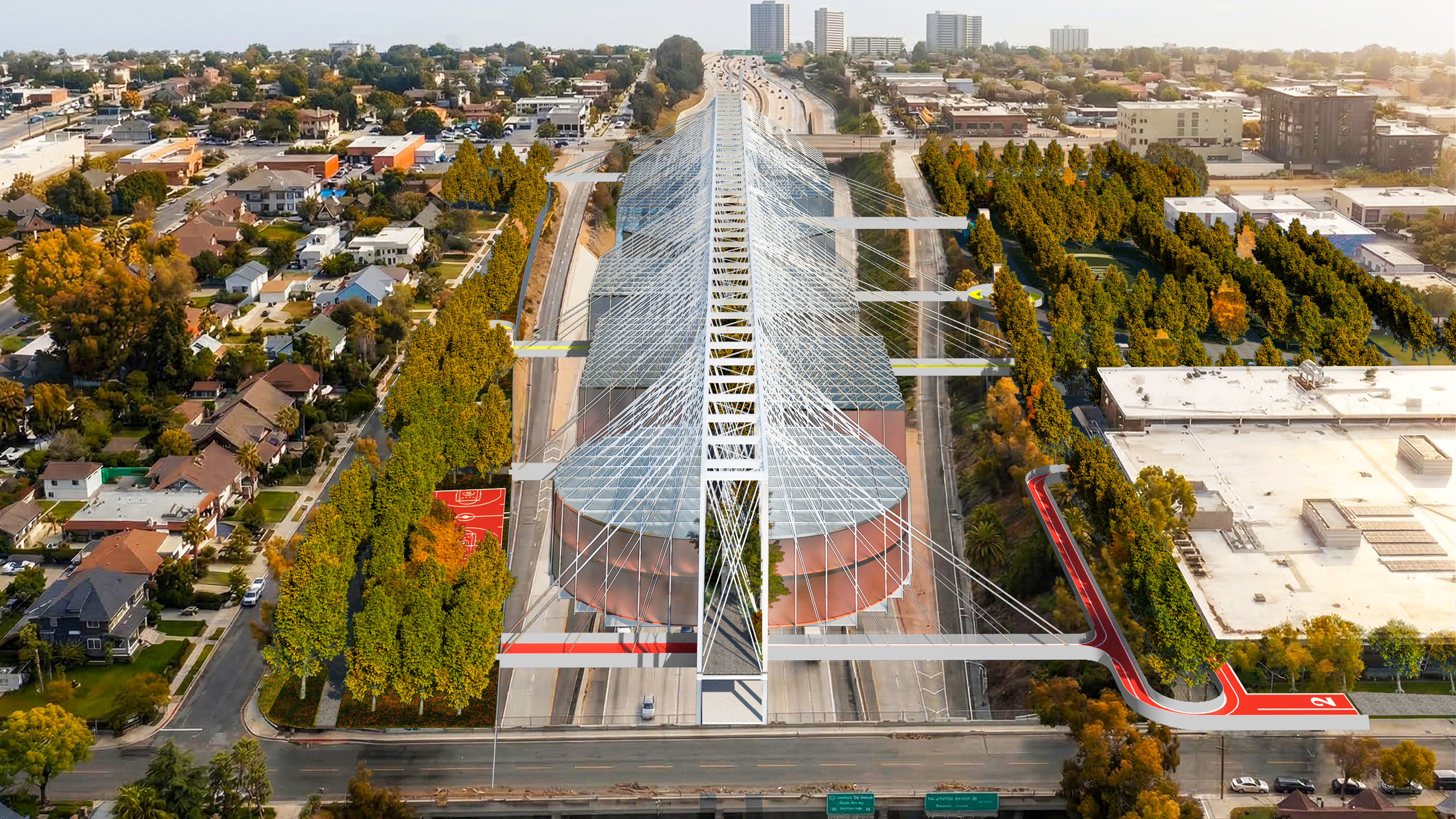
Nabil Davidson and Zirui Wang drew inspiration from the grand geometry of the original transcontinental highway system, treating the freeway's edges as an opportunity to reorganize the urban plan rather than patch communities together.
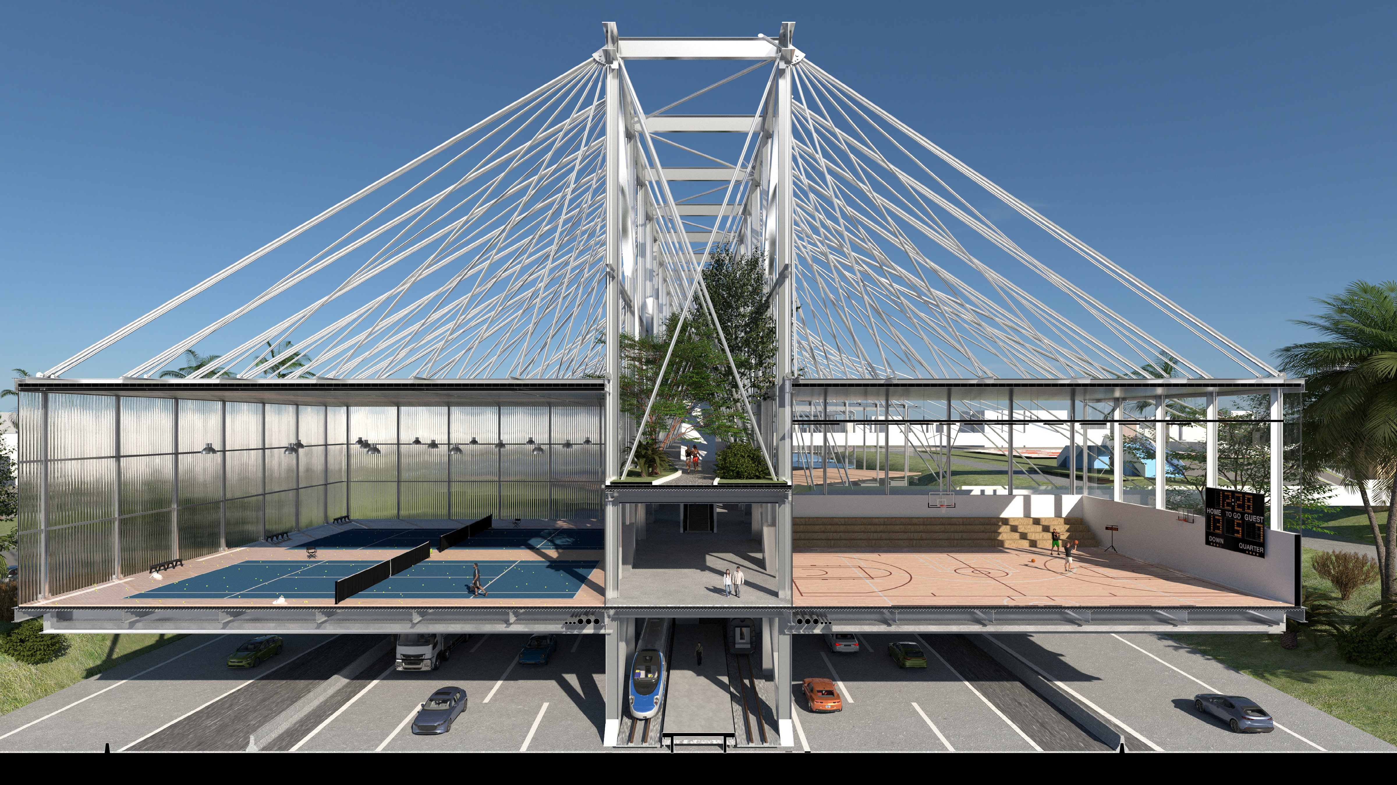
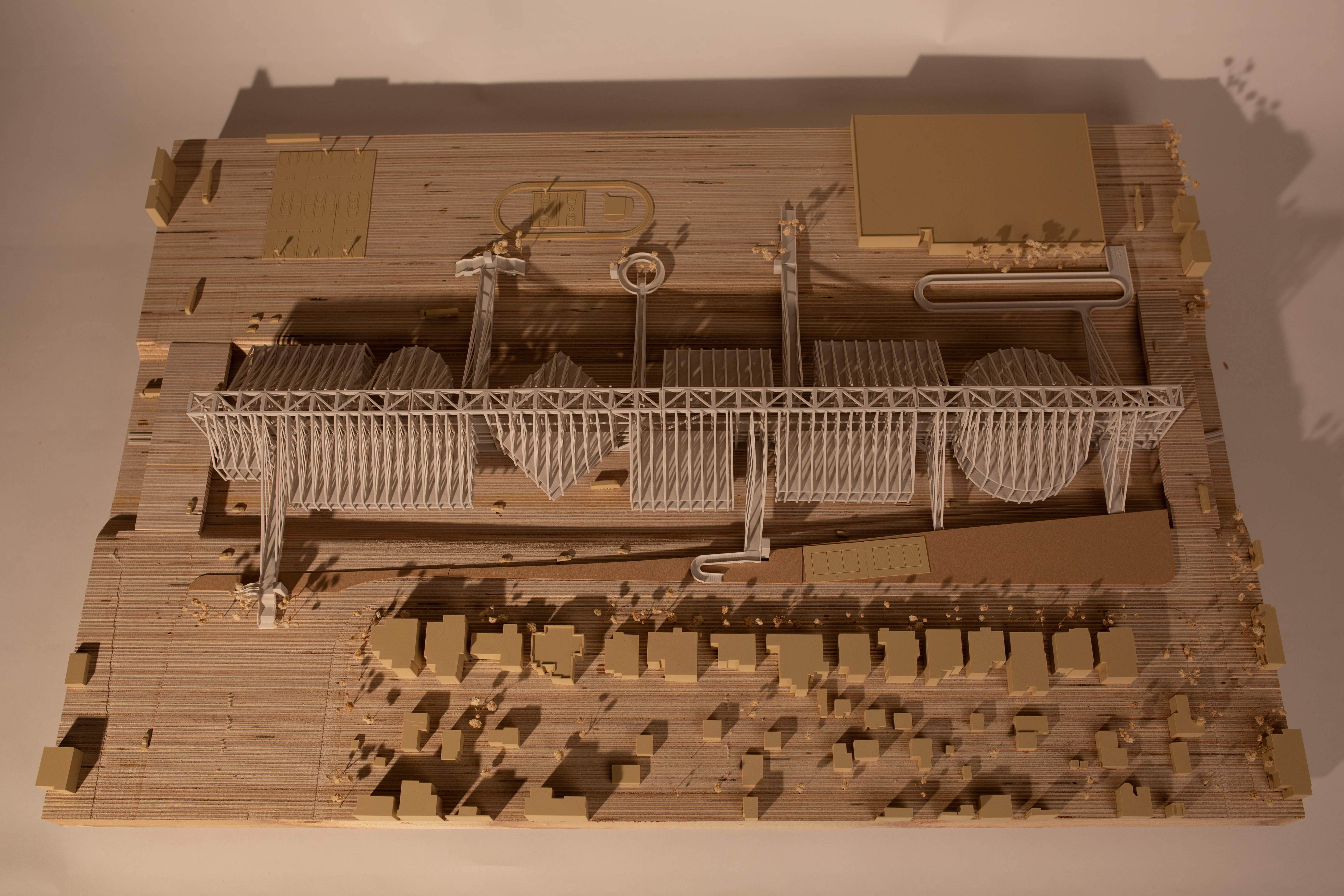
After testing several configurations for a bridge spanning the 10, they landed on an "arrow and median" scheme: a central spine corridor, with recreation program "hooked on" along its length. It's an ambitious amount of infrastructure folded into one site, but Davidson and Wang prioritized organic form and moments of surprise, like a roof that opens to the sky rather than a rigid mega-bridge. Beneath a suspended cable bridge, the median doubles as a light-rail corridor, with additional bridges reaching toward all four corners of the site to support courts and an aquatics facility.
On the same site, Yizhen Mao and Yanshen Xu approached the void differently: multiplying the points of connection rather than concentrating them. Their scheme uses a village-like, woven configuration, with an athletic track acting as a "lasso" stitching the two sides of the neighborhood back together.
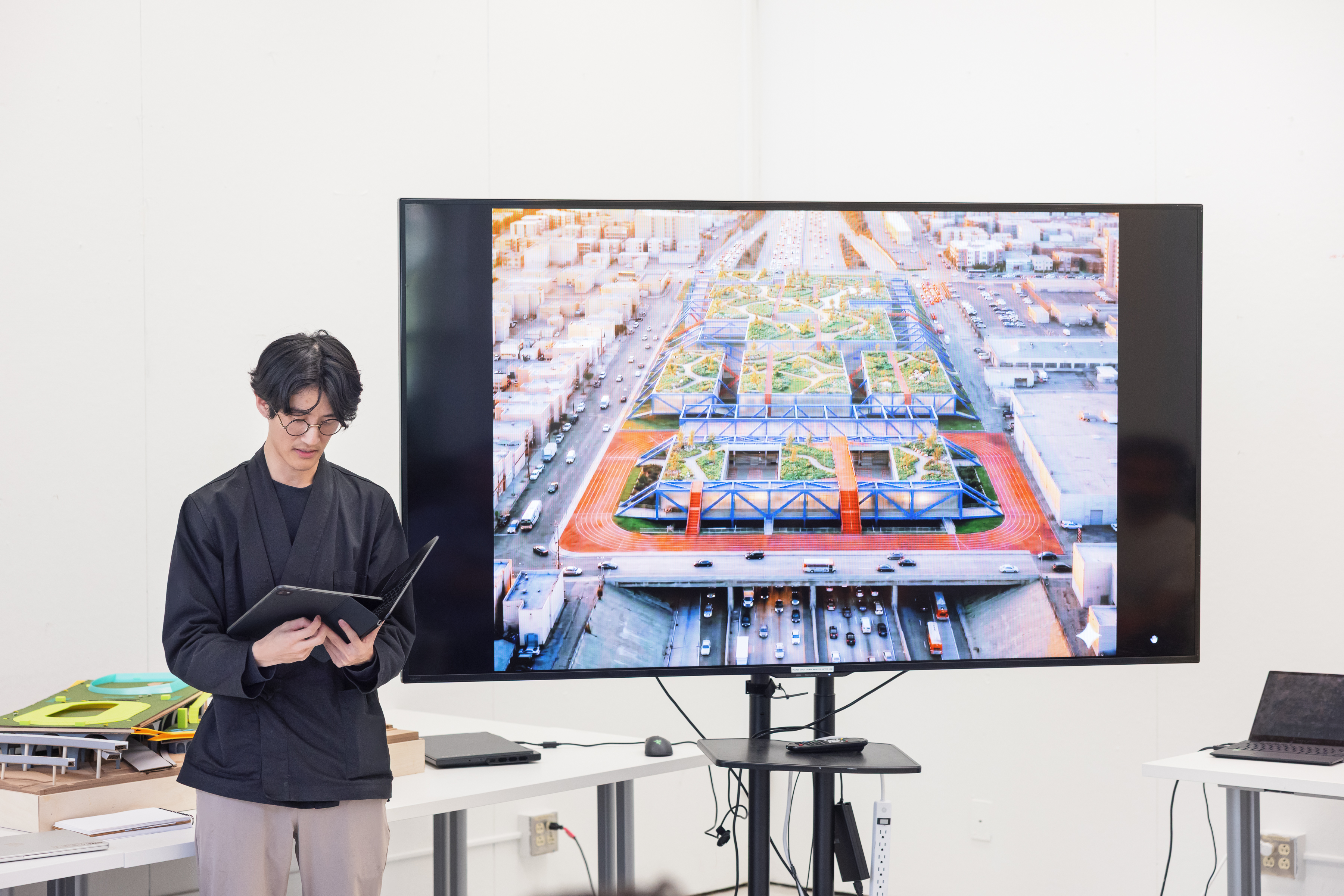
One open question the team asked themselves and the studio: how much exercise and recreation space can realistically sit directly over an active freeway before exposure to noise and pollution becomes the design's biggest liability?
Site 3: Capping the Colossus at the 405/10 Interchange
The studio's largest and most daunting site is the roughly one-million-square-foot interchange where the 405 meets the 10 on LA’s Westside: a three-level, concrete structure that looks impressive, but is no longer constructed today. The monumental interchange looms over a dense, middle-class residential neighborhood.
For "In the Loop," students Baiqianqian Sun, Amber Grovet, and Yue Xi chose to cap the highway outright, after debating whether to build over or under it. Their scheme layers program vertically: an upper level of open-air sport sitting atop a capped freeway below. A four-structure core, topped with a rippled concrete surface, translates the interchange's high-speed, grid-based mobility into something slower and more human-scaled; walking and biking paths feel less like infrastructure and more like neighborhood.
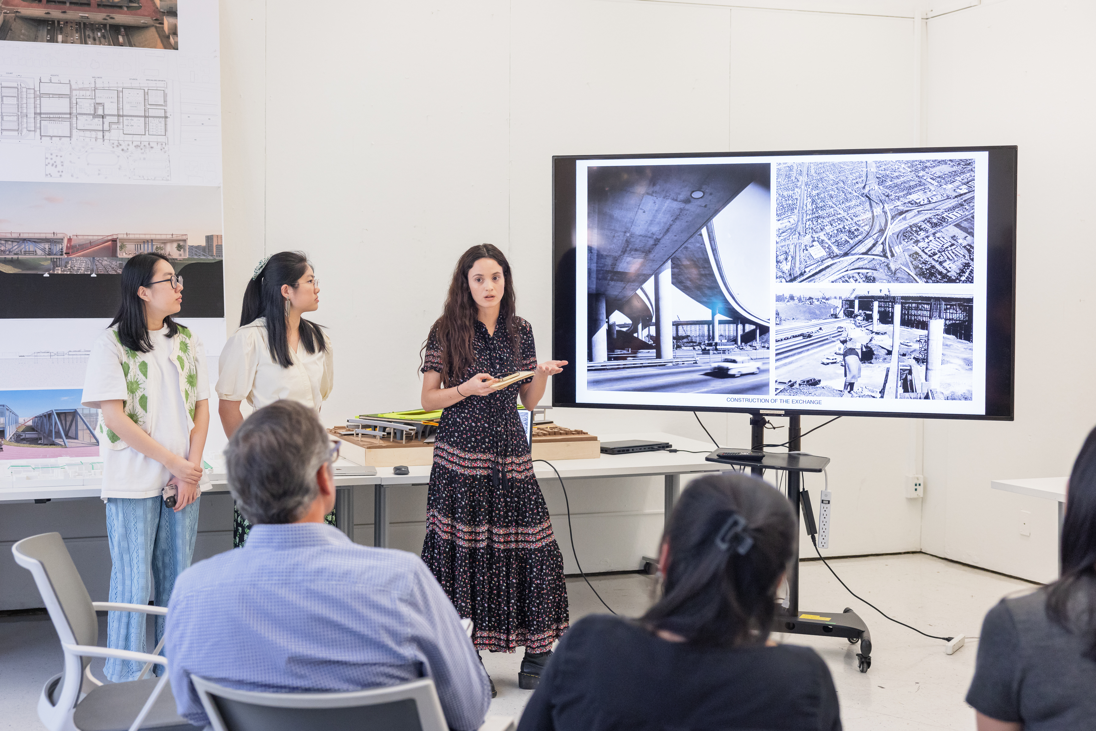
The project brings porosity to an otherwise impenetrable site. Access comes from street level on two sides, and the team folded an air-purification system into the new tunnels, treating environmental restoration as part of the architecture, not an afterthought.
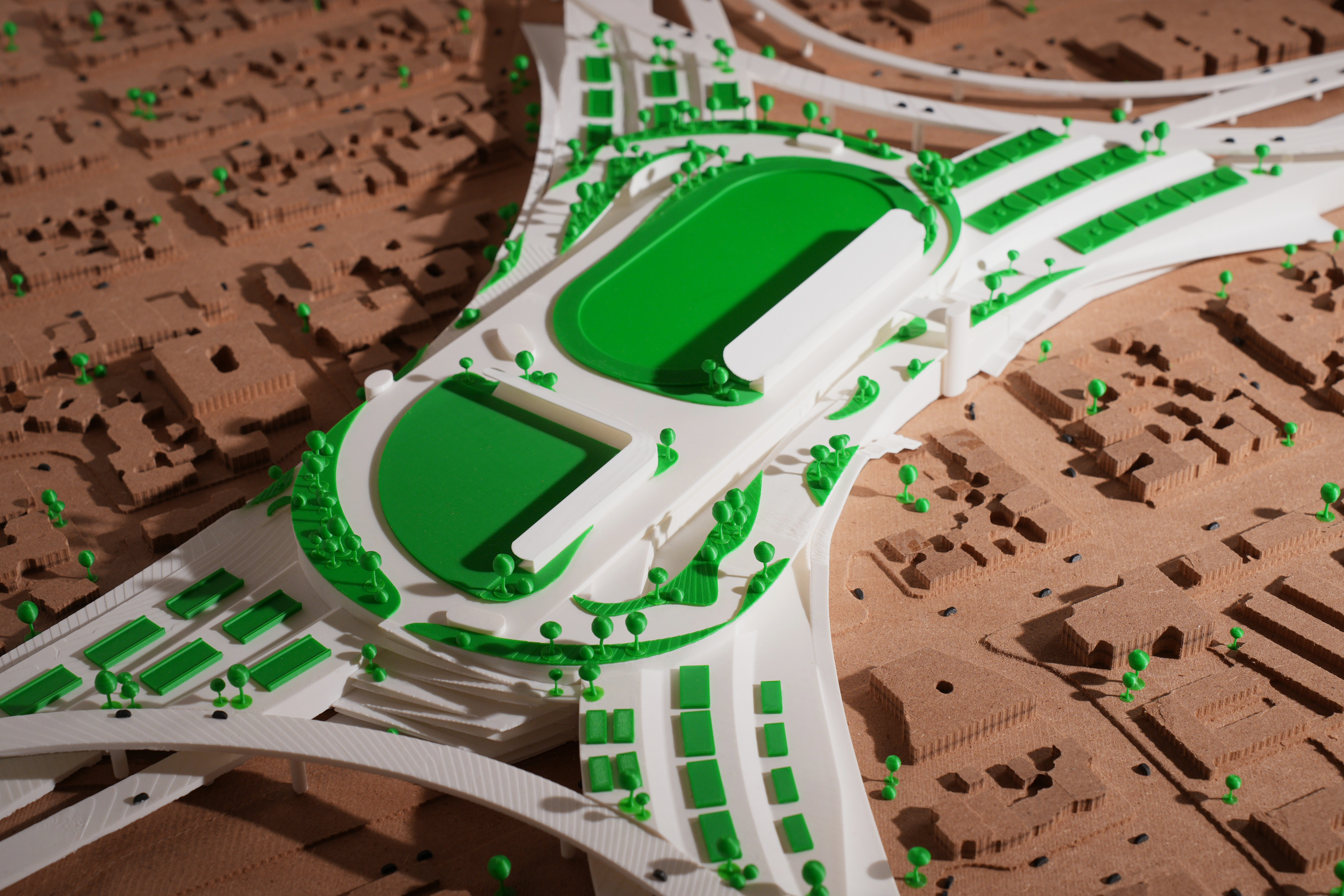
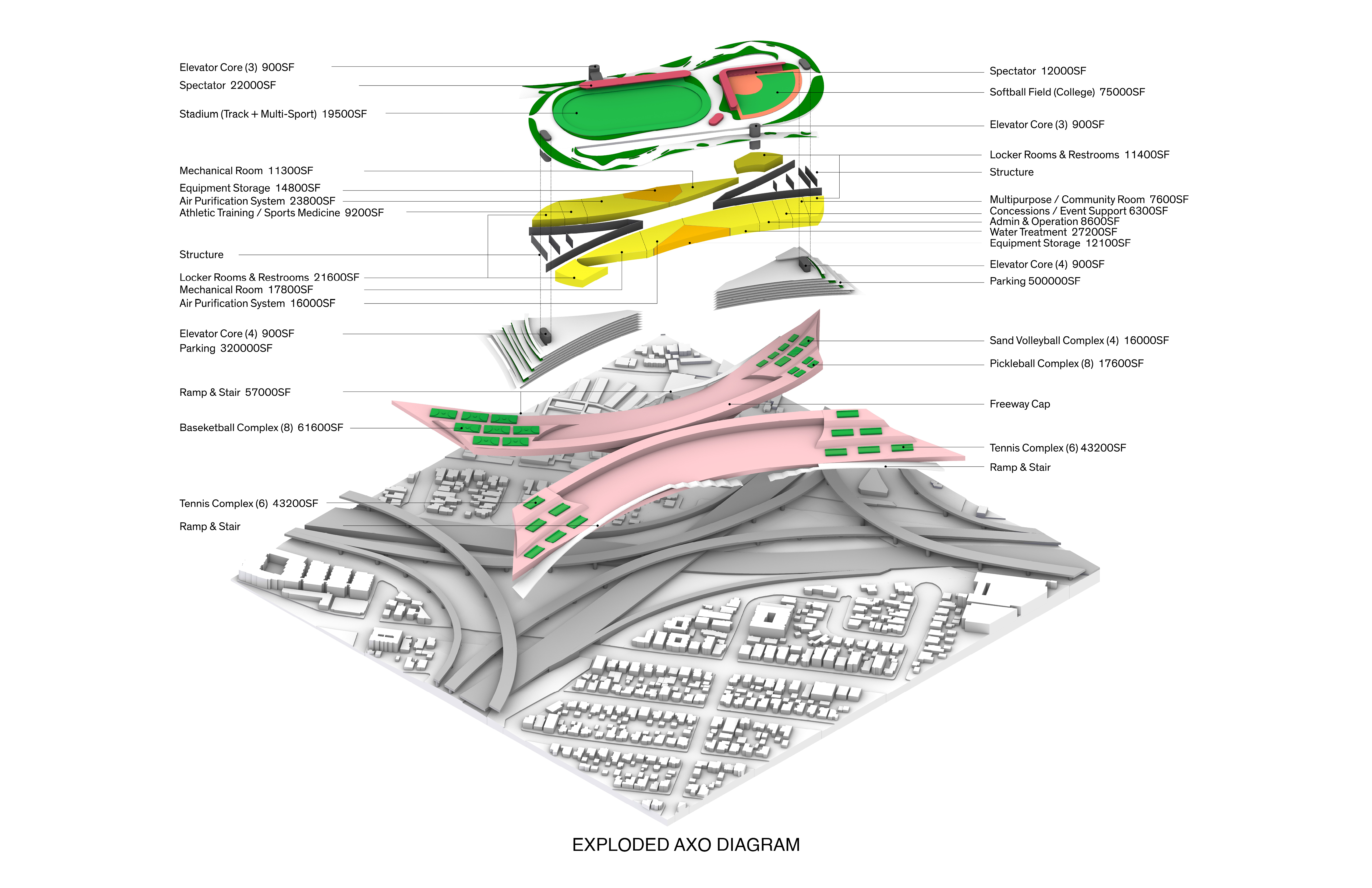
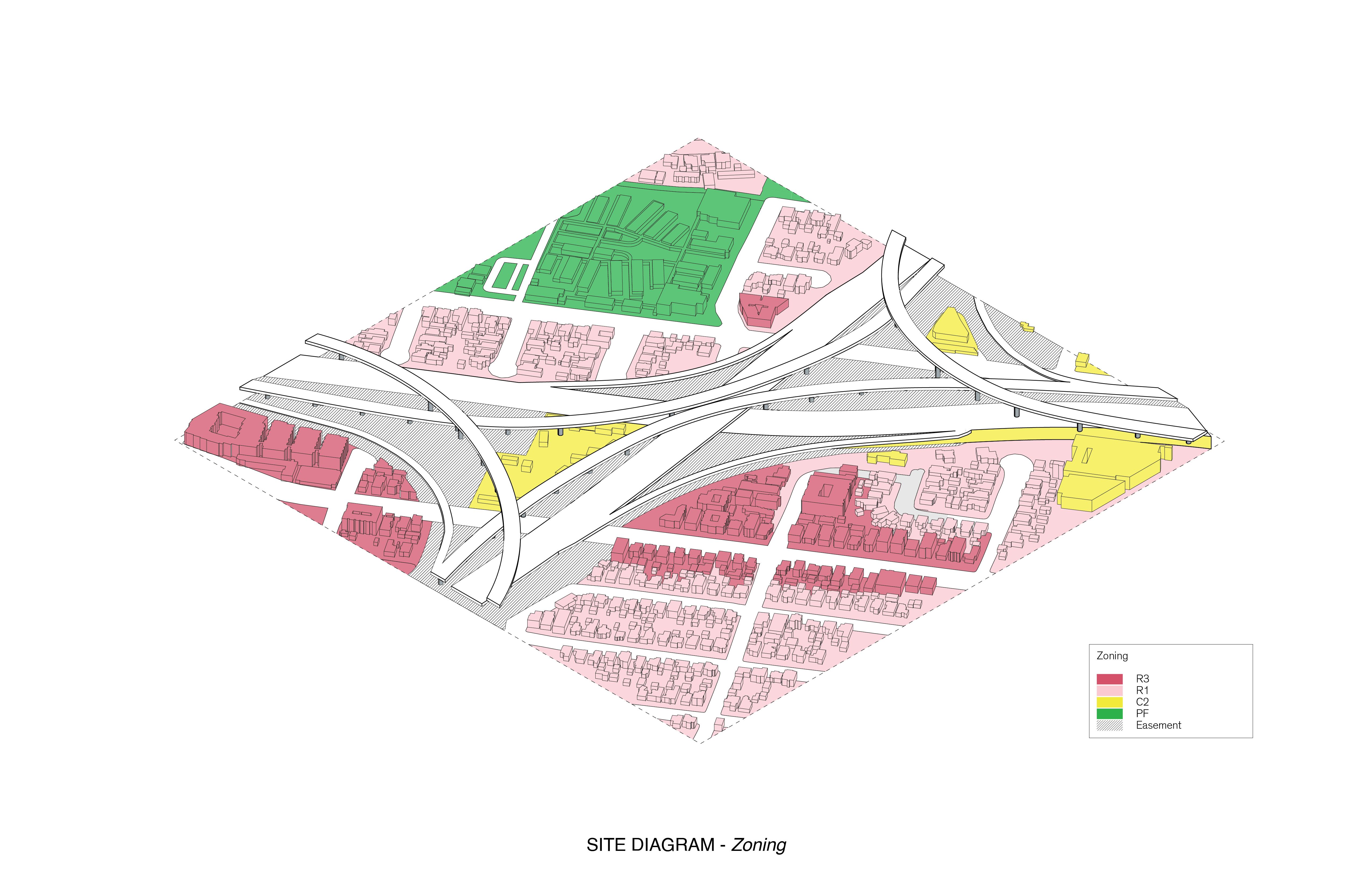
At the same site, Alexander Morris pursued a different vision of density: essentially a city built atop a city. The proposal stacks two surfaces — open-air sports grounds on top, low-rise housing below — using arching, elegant structural "wings" instead of another flat slab, retaining some of the interchange's existing kinetic energy and scale. It's an explicitly regional proposal, framed less as a self-contained project than as one piece of a larger puzzle: what recreational and connective gap is this site actually filling for the neighborhoods around it?
Optimistic Proposals, With Open Questions
When Los Angeles hosted the 1984 Olympics, fleets of buses turned chronic gridlock into a temporary, functioning system — proof that the city's mobility problems aren't unsolvable. As LA prepares to host the world again in 2028, this studio offers an early, provocative sketch of what else might be possible: turning the corridors that once divided the city into the infrastructure that finally connects it.
But each team ran into some version of the same hard questions — challenges that no doubt LA will need to confront on these sites and elsewhere.
How do you redistribute vehicular traffic when travel lanes are reallocated? Do these new destinations generate more congestion than they solve? Can you build major recreation space directly over active freeway corridors without exposing people to the noise and pollution below?
Rost pushed his students to sit with those tensions rather than design around them, which pushed each of these five projects toward real proposals rather than abstractions.
“Every host city leaves a mark,” Rost observes. “Tokyo built the bullet train, Barcelona opened its coast, Paris cleaned the Seine. Our Seine is the 405.”
Related topics |
Urban Strategy, Mobility |